This week (January 25, 2012), NASA released what it said is the “most amazing high definition image of Earth” ever. It’s part of NASA’s Blue Marble series. It’s composite image that uses a number of swaths of the Earth’s surface taken on January 4, 2012.

Most recent Blue Marble image, a composite made from multiple images acquired on January 4, 2012. Credit: NASA/NOAA/GSFC/Suomi NPP/VIIRS/Norman Kuring
This image was assembled from images taken from NASA’s most recently launched Earth-observing satellite — Suomi NPP – which was officially named on January 24, 2012 for the late Verner E. Suomi, a meteorologist at the University of Wisconsin who is said to be “the father of satellite meteorology.”
Suomi NPP is NASA’s next Earth-observing research satellite. NASA says it is the first of a new generation of satellites that will observe many facets of our changing Earth.

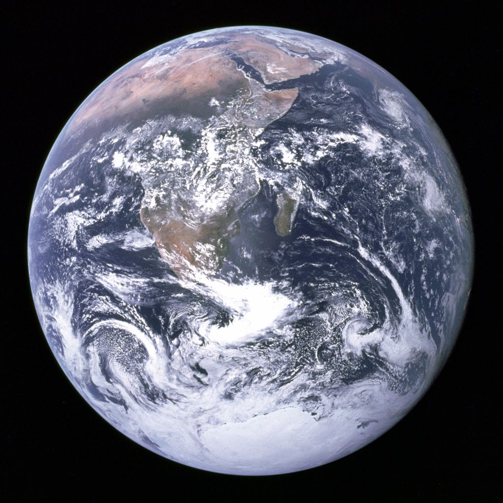
Original Blue Marble image, taken by Apollo 17 astronauts in 1972. This image changed the way people in 1972 thought about the world. Image Credit: NASA
For contrast, here is the original Apollo 17 Blue Marble image, taken by astronauts on their way to the moon. Here’s the original caption:
View of the Earth as seen by the Apollo 17 crew traveling toward the moon. This translunar coast photograph extends from the Mediterranean Sea area to the Antarctica south polar ice cap. This is the first time the Apollo trajectory made it possible to photograph the south polar ice cap. Note the heavy cloud cover in the Southern Hemisphere. Almost the entire coastline of Africa is clearly visible. The Arabian Peninsula can be seen at the northeastern edge of Africa. The large island off the coast of Africa is Madagascar. The Asian mainland is on the horizon toward the northeast.
The Apollo astronauts had the sun behind them when they took the image, so they are seeing all of Earth’s day side – a fully illuminated Earth – much as we sometimes see a full moon in our sky. To the astronauts, Earth had the appearance of a glass marble, hence the name.
Since 1972, NASA has produced a whole series of Blue Marble images. You can see and learn about them here.
Bottom line: On January 25, 2012, NASA released what it said is the “most amazing high definition image of Earth” ever. It’s part of NASA’s Blue Marble series. It’s composite image that uses a number of swaths of the Earth’s surface taken on January 4, 2012. The original Blue Marble image, taken by Apollo 17 astronauts on their way to the moon in 1972, is possibly one of the most viewed images in the world.

沒有留言:
張貼留言